Breadcrumb navigation
Positioning Technology
1. Introduction

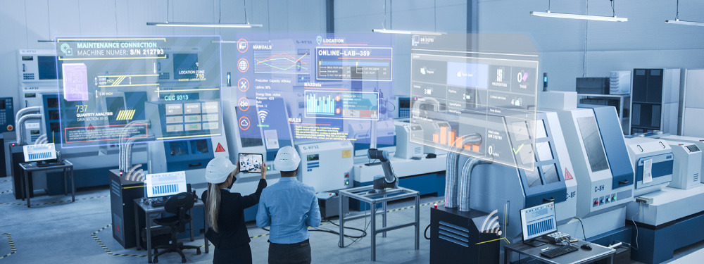
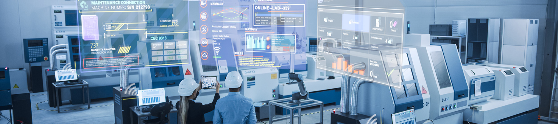
In recent years, with the promotion of Internet of Things (IoT) and DX (Digital Transformation), efforts have been made to sensing the state of machines, structures, people, products, and treat it as digital data. Digital data also requires information such as where machines, structures, people, products, etc. exist, and location information is indispensable. In this technical explanation, we will introduce the technology for acquiring location information and show the mechanism and characteristics of each.
2. Types and Mechanisms of Positioning Technology
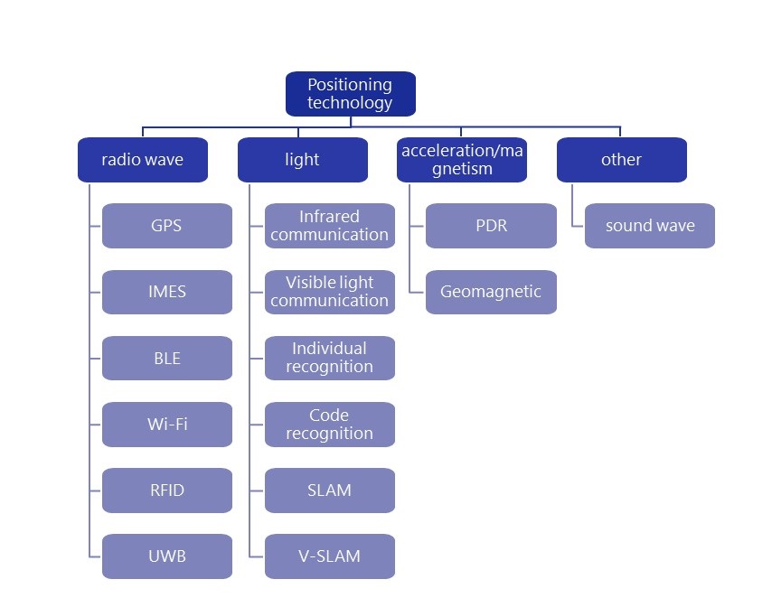
There are many positioning technologies. Categorization on the principle of positioning can be classified as shown in Figure 1.
Positioning technology using radio waves is a technology that estimates the position of a child unit by transmitting and receiving radio waves between the parent unit and the child unit. Radio waves are characterized by being able to transmit and receive even if there is shielding. However, if the cover is metal, it reflects or absorbs radio waves, so it may not work well in environments with a lot of metal. The most commonly used is the Global Positioning System (GPS). By receiving radio waves from GPS satellites, the location of the terminal is determined. In addition, BLE (Bluetooth Low Energy), Wi-Fi, and IMES (Indoor MEssaging System) are used as positioning technologies used indoors.
Positioning technology using light is a technology that estimates positions using visible light that can be confirmed by the human eye and infrared rays that cannot be confirmed by the human eye. Light is characterized by its high straightness, which improves position accuracy, but it is not possible to estimate the position when there is something in between that shields light. Positioning technology using light can be subdivided into technology that uses light to communicate and analyzes location using images. The technology for communicating using light is a technology that estimates the position of child units by communicating between the parent unit and the child unit using infrared rays and visible light. The technology of analyzing the position using images is a technology that estimates the position of the object and the position of the camera by photographing the object to be positioned with the camera and the surrounding environment. In recent years, the technology of estimating the position using images has attracted attention. Individual recognition identifies an individual from an image and estimates the actual position from the camera's angle of view and the shooting position in the image. Code recognition recognizes specific codes (barcodes, QR codes, color barcodes, AR markers) and estimates their location. In addition, it detects the movement of cameras and 3D sensors captured from images captured by the camera and point cloud data obtained by 3D sensors, and simultaneously performs self-position estimation and environmental mapping SLAM (Visual Complex and Mapping) and V-SLAM (Visual Complex Localization and And Mapping) has also been put to practical use.
Position positioning technology using acceleration / magnetism is a technology that estimates the amount of movement of the terminal from the momentum and the direction of travel of the terminal using the acceleration sensor and magnetic sensor attached to the terminal. By estimating and accumulating the amount of movement of the terminal at regular intervals, it is possible to acquire the movement trajectory of the terminal. However, since errors are accumulated as the amount of movement is accumulated, it is necessary to separately correct to get the accurate position. It is commonly referred to as Pedestrian Dead Reckoning (PDR) and is used to estimate the amount of movement in car navigation and smartphones.
Other positioning techniques include sound waves. This is a technology that installs a child machine that transmits sound waves in the facility, and estimates the position by receiving the sound wave emitted by the child unit by the parent machine that receives the sound wave. Since sound waves can be received even with microphones such as smartphones, it is relatively easy to secure the parent unit. However, the disadvantage is that it is vulnerable to shielding and environmental sound.
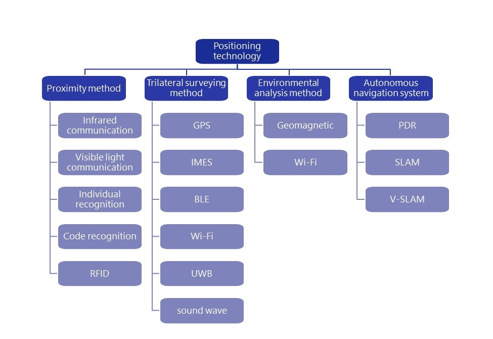
In Figure. 1, it was classified by principle, but in Figure 2, it is classified by positioning method. The proximity method is a method of estimating the position by the presence (proximity) of the child machine within the measurement range of the parent machine in relation to the parent machine on the measurement side and the child unit to be measured. High positioning accuracy can be obtained when the measurement range of the parent unit is narrow, but positioning accuracy tends to be low when the measurement range is wide. The triangulation method is a method of estimating the position of the child unit using trilateral surveying in relation to the parent machine that is two or more reference points and the child machine to be measured. The length of the side is generally used to use the intensity and arrival time of the radio waves and sound waves emitted by the parent unit. In order to improve positioning accuracy, it is necessary to reduce the error of the length of the side, and the strength and arrival time must be measured in detail. The environmental analysis method estimates the location of the terminal by measuring the surrounding environment of the terminal to be measured. The position of the terminal is determined by measuring the environment (geomagnetic or Wi-Fi access point) of the range to be moved in advance and matching the measurement result with the result measured by the terminal. To maintain position accuracy, it is necessary to measure the environment regularly.
The autonomous navigation method estimates the movement trajectory of the terminal by estimating the amount of movement by using the sensor mounted on the terminal to be measured sequentially. Accelerometers include acceleration, magnetism (PDR), camera (V-SLAM), and 3D sensors (SLAM). Since errors are accumulated as the amount of movement is accumulated, a mechanism for correcting at an exact position separately is required.
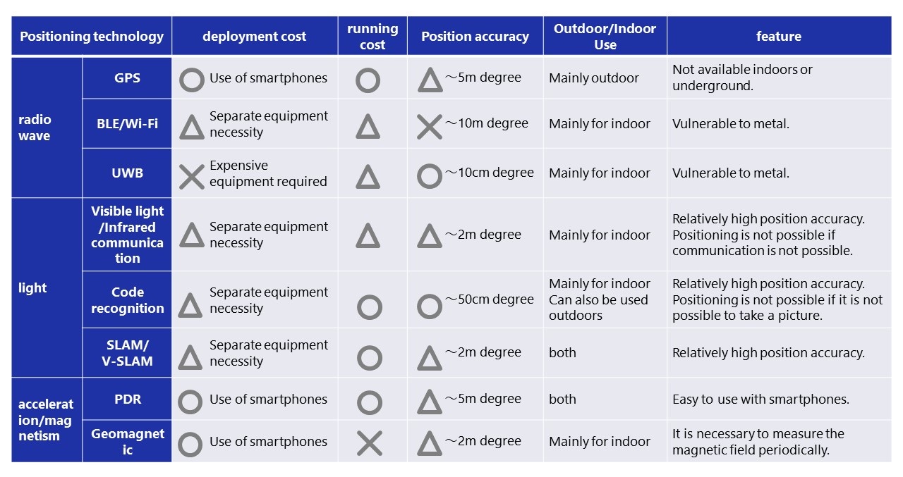
3.Characteristics of Positioning Technology
Table 1 shows the characteristics of each positioning technology. Each positioning technology has its own characteristics, and it is important to choose according to the use case used. In general, the higher the position accuracy, the more expensive the deployment cost tends to be. In addition, running cost during operation is also an important selection point. In the method using radio waves, it is necessary to install a terminal that uses power for positioning, and the cost of the terminal and the trouble of replacing the battery occur during operation. In this way, it is necessary to select the optimal positioning technology considering the requirements such as position accuracy required in the use case, introduction cost and running cost, and the presence or absence of space to install the terminal.
4.Conclusion
Positioning technology was explained. Positioning technology can be categorized depending on the principle used and the method of positioning, and each has different characteristics. It is important to choose the method that fits your use case and cost. NEC Communication Systems provides material monitoring solutions that use QR codes and BLE tags to monitor the location of materials. We also offer NEC marker positioning software using AR markers. This software uses the principle of light to recognize code, but by using AR markers in the code, positioning is possible from a greater distance and with higher accuracy. If you are interested, please refer to the link below.
We will introduce software that acquires the position of goods, forklifts, and other objects with high level of accuracy by utilizing the 3D position information obtained when AR markers are photographed with a camera.

NEC Marker Positioning Software